COVERED BRIDGE TOUR 2026
AS OF JUNE 28, 2026 THE MAIN ROAD WORK IS DONE, ONLY THE SMALL DETOUR IN 42 MILE ROUTE IN EATON, AND THE SMALL DETOUR IN GERMANTOWN ON 103/ 70 ROUTS REMAIN ! Informationfor 2026's ride is up: . Map, GPS files, other info. & legal release is posted. There will be small detours on the 103, 70 & the 42 mile routes. See detail maps below. The GPS files DO NOT HAVE DETOUR INFO. The 20 mile route has NO detours ! Be careful on the bridges. Walking on them is better. With recent heavy rain and flooding there is more junk on the roads.
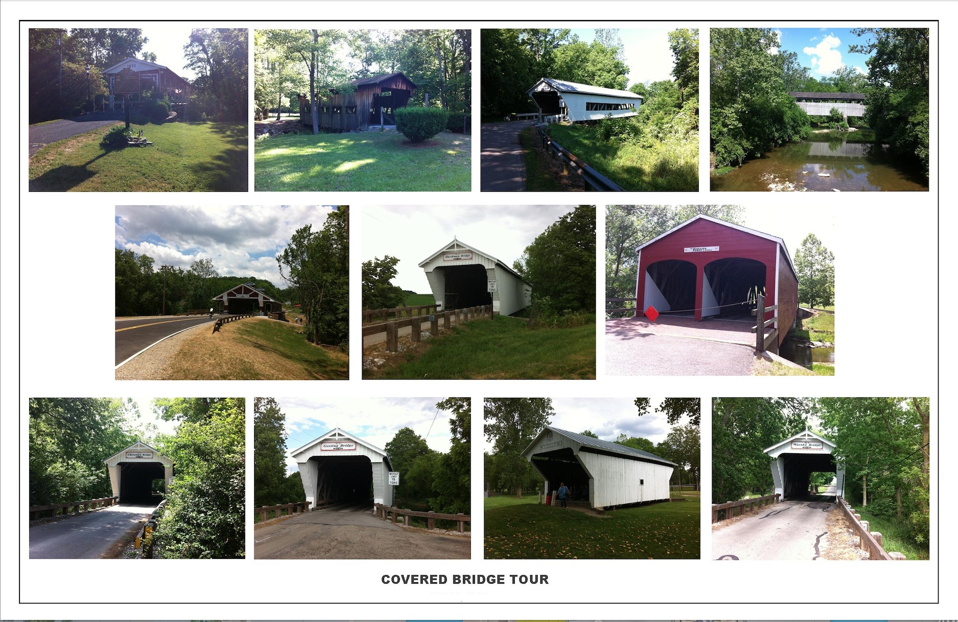
There is no registration, just a release to sign on the day of the ride. The ride is free.
Return to a time when bicycles were new, cars were few and these covered bridges were in their youth. The oldest bridge on this tour is almost 200 years old ! Thankfully we have paved roads now. Rolling to hilly terrain. For about 55 years this ride has been celebrating their heyday. This ride is based on The Trotwood Covered Bridge Tour/Century (sponsored by the Trotwood-Madison Historical Society, the Trotwood Parks & Rec. Dept., and Dick Cross' Peddler shop's/The Trotwood Wheelmen Trotwood) , that existed from the early 1970s to about 1983. Nick Zantal of the DCC made the tour a club ride, and since 1988 Mark and Mary Buchwalder have directed the event, adding a south loop and more. The full route has 11 covered bridges !
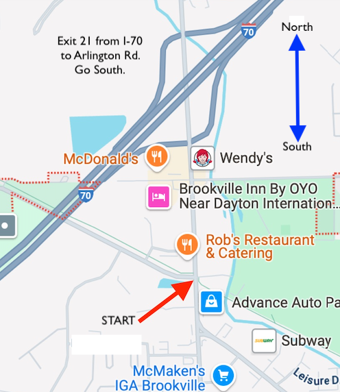
START: 8:00 am, Intersection of Wolf Creek Trail and Arlington Rd. : Red Arrow in picture below. 700 Arlington Rd. Brookville, OH 45309 Brookville, OH. Registration is from 7:30 am until 8:00 am. We may be gone riding already if you arrive later than this! Most people start at 8:00, so get to the start area early so you can ride with others.
PARKING: There a small parking lot is at start. Street parking is available near the LCNB Bank. (Nearby Golden Gold Park doesn’t open until 8 AM., but SOMETIMES THE GATE IS OPEN EARLY; the park has a large parking lot and bathrooms. I haved, in the past, asked the park people to get the gate opened early, and was told would it be done. It's a hit or miss; I quit asking. Sometimes the Exit gate "one way", to the east, is open, and you can get in that way. If you are coming from the North, turn Left past Wendey's and the Golden Gate park will on your right shortly. There is a path/ sidewalk/ maintenancer drive way, from the SW area behand the the baseball diamonds, to the bike path. Turn right (west) on the real path and the start/ little parking lot is nearby, on Arlington Rd.)
Map to the start: BIG RED ARROW:
Covered bridges should be crossed with care, walk if you want to be safer. Wear a helmet.
RESTROOM and WATER IS AVAILABLE nearby the start at QUICK stores, and restaurants, gas stations and Hotels, are near the highway exit.
ROUTES: 20 miles (2 covered bridges) 42 miles (5 covered bridges) 70 miles (7 covered bridges) 103 miles (11 covered bridges)
FACILITIES: NO FOOD OR DRINKS ARE PROVIDED. All routes pass through small towns where water, restrooms, snackfoods, etc. are available at "quickmarts" and restaurants. BRING MONEY OR YOUR OWN FOOD. NO "SAG" SERVICE WILL BE PROVIDED- BRING A PUMP AND PATCH KIT AND TOOLS AND KNOW HOW TO USE THEM. Be prepared for the weather.
Directions to the Start: From I-70 Exit #21, Go South 0.4 mile south on Arlington Rd., to small parking lot on the east side.
WE DON'T PAINT ROUTE ARROWS ON ROADS. Get the maps & information pages.
2026 RIDE WITH GPS files:
103 mi route: https://ridewithgps.com/routes/50958119
70 mi route: https://ridewithgps.com/routes/35775889
42 mi route: https://ridewithgps.com/routes/42740415
20 mi route: https://ridewithgps.com/routes/29917869
-------------------------------------------------------
FOOD, BATHROOMS and ROUTE DETAIL INFO:
Click/drag or Control S or what ever you need to do to save the pages (below) as needed, and print them.
Info page 1 below:

Info page 2 below:

Set your printer to "Fit to page".
MAP 1 below:

MAP 2 below:

xxxxxxxxxxxxxxxxxxx
DETOUR INFO PAGE #1
 xxxxxxxxxxxxxxxxxxxxxx
DETOUR INFO PAGE #2 BELOW

+++++++++++++++++++++++++++++++++++++++++++++++++++++
Legal release form for Non- DCC members below:
Dayton Cycling Club members: sign Tour Roster day of event.

QUESTIONS ? e-mail: buchmark@hotmail.com